Google loves data. It's just gobbling it up for no good reason, it's using it to let users of Google Maps know how busy somewhere will be at a particular time. That's a service that's been available for things like restaurants for a while - and now Google is bringing it to public transport too.
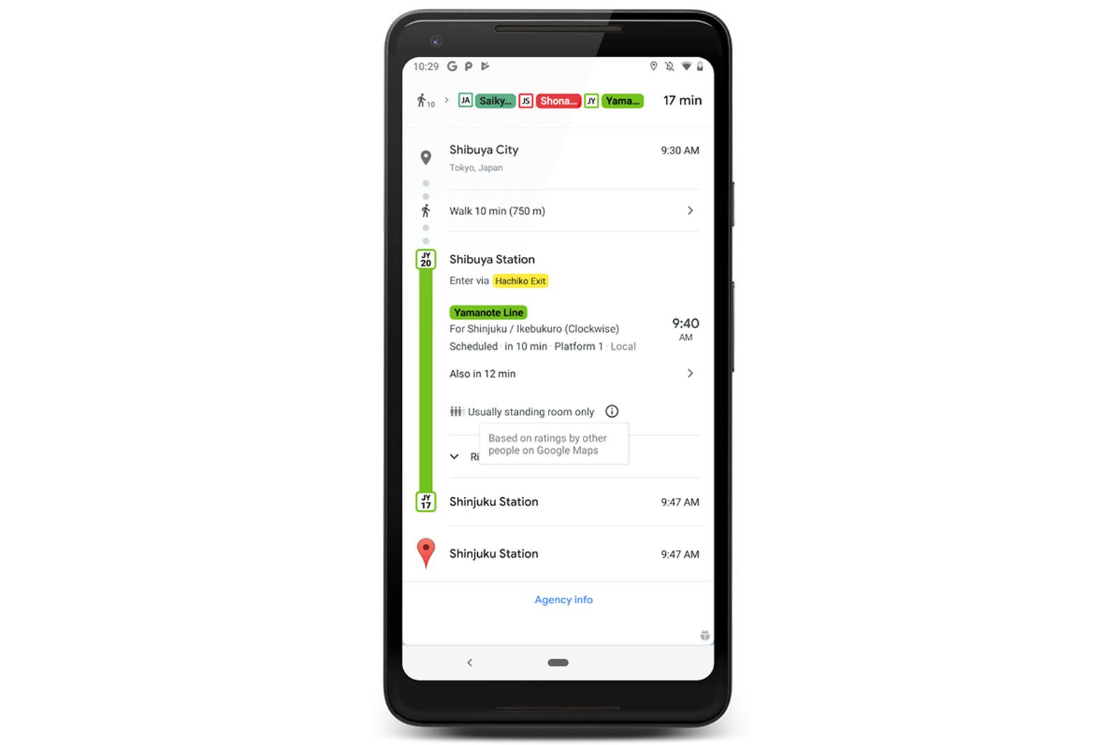
That means that public transport routes in major cities will now be able to tell you how crowded your bus or train is likely to be, so you can decide whether you want to cram on or if you'd rather travel at a different time.
Google is also adding information about traffic delays for places where they don't have that information from the service operators. That should mean you have more accurate timings for your trips and all delivered through Google Maps.
This new range of information is rolling-out in the UK from today, enhancing the transports systems in Birmingham, Brighton, Bristol, Cambridge, Cardiff, Coventry, Crawley, Edinburgh, Glasgow, Leeds, Liverpool, London, Newcastle, Nottingham, Oxford, Reading, Sheffield and Southampton.
The roll-out will extend to over 200 cities on Google Maps and the information will be available both to Android and iOS users.
To find it, all you'll have to do is plan your route as normal in Google Maps. Using the "transport" tab you can see all the transport options available to you and you should then see the new information contained within those details.


