You’ve probably seen a Google Street View car collecting map data, or at least used the service online. But what you might not know is that HERE Maps, which has been around as part of Nokia since 2007, makes more detailed maps than anyone else thanks to its cars' sensors. They're in London right now mapping every centimetre, literally.
So smart are the HERE Maps cars that soon you’ll be told, rather than "turn left in 200 yards", to "make a left at the big church on the corner", for example. These cars can even measure the texture of surroundings for more accurate information relayed to you when driving. But what makes it this special?

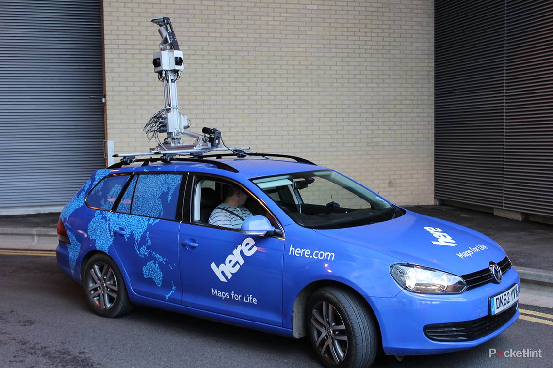
Unlike Google’s cars the HERE Maps motors use LiDAR technology which has an accuracy of up to 2cm, meaning the images are so detailed you could read the headline off a newspaper. Other than inevitably providing some hilarious shots that spread all over the internet, this also helps in mapping. Coupled with a smart algorithm, GPS and cameras the car can recognise, read and understand road signs.
Yup, we were amazed too - that means one-way streets, for example, are registered instantly without a human ever needing to get involved. This is thanks to the LiDAR combined with Earthmine that recognises and pulls out writing of street names, signs, and other written information. Check out the LiDAR's slightly creepy all-seeing spinning "eye".
But humans are not out of the equation just yet. We had a driver who’s one of many out and about in the cars. They drive specified routes that get inputted based on areas that haven’t been covered or need another pass. Then there’s the back end. For intelligent directions like, "Go left at the church", human analysts are going to have to go through all the data.
But what if it changes? We hear you say. The cars go out regularly to make sure the maps are up to date and HERE also uses 80,000 other external sources to maintain up to the second accuracy.
To put it in perspective, the HERE vehicles capture 700,000 3D data points at a time which is up to 140 gigabytes of data a day. That’s thanks to the cameras, of which there are four shooting 360-degrees around and 120-degrees up, for a total 68-megapixel image.
HERE Maps is driving the street of London right now but should have 27 countries mapped out before the year is done. And, another advantage of HERE Maps, they can all be downloaded so you can navigate abroad without paying for data. Ideal when using the Car Navigation feature on your mobile or GPS-toting tablet. And the best part? It's all free.